
An insurance company has created a new interactive map that tells people about the car crime rate close to them, aiming to give users better insight into where to park their car.
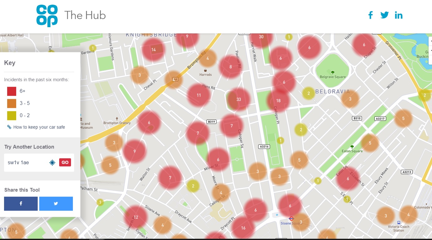
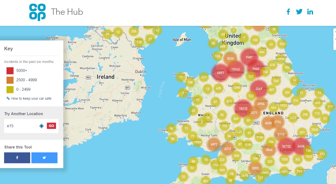
Co-op Insurance has built the map using crime data published by the Home Office, which covers the period from November 2016 to April 2017 and enables users to enter their postcode and see recent vehicle crime nearby.
 (Screenshot/Co-Op Insurance)
The colour-coded map then plots recent crimes, with patches of high crime marked in red, medium in orange and down to yellow for spots with two or fewer reported incidents.
London and other major cities were perhaps unsurprisingly the areas with the most reported incidents in the last six months.
 (Screenshot/Co-Op Insurance)
The interactive map also contains a help section on how to keep a car safe if parked on a drive, the road or in a car park.
“While vehicles and their technology systems have become smarter over the years, vehicle crime continues to be one of the most well reported instances of police recorded crime in the UK,” Co-op Insurance said.
“Along with calling for a taxi home, there are a whole host of inconveniences to consider when it comes to having your car stolen: extra time and expense for excursions, loss of personal possessions and identity fraud could be among the worst outcomes.”


Why are you making commenting on The Herald only available to subscribers?
It should have been a safe space for informed debate, somewhere for readers to discuss issues around the biggest stories of the day, but all too often the below the line comments on most websites have become bogged down by off-topic discussions and abuse.
heraldscotland.com is tackling this problem by allowing only subscribers to comment.
We are doing this to improve the experience for our loyal readers and we believe it will reduce the ability of trolls and troublemakers, who occasionally find their way onto our site, to abuse our journalists and readers. We also hope it will help the comments section fulfil its promise as a part of Scotland's conversation with itself.
We are lucky at The Herald. We are read by an informed, educated readership who can add their knowledge and insights to our stories.
That is invaluable.
We are making the subscriber-only change to support our valued readers, who tell us they don't want the site cluttered up with irrelevant comments, untruths and abuse.
In the past, the journalist’s job was to collect and distribute information to the audience. Technology means that readers can shape a discussion. We look forward to hearing from you on heraldscotland.com
Comments & Moderation
Readers’ comments: You are personally liable for the content of any comments you upload to this website, so please act responsibly. We do not pre-moderate or monitor readers’ comments appearing on our websites, but we do post-moderate in response to complaints we receive or otherwise when a potential problem comes to our attention. You can make a complaint by using the ‘report this post’ link . We may then apply our discretion under the user terms to amend or delete comments.
Post moderation is undertaken full-time 9am-6pm on weekdays, and on a part-time basis outwith those hours.
Read the rules hereLast Updated:
Report this comment Cancel