
Location: Flowerdale’s Falls, Wester Ross
Grade: Moderate waymarked walk
Distance: 3 miles/5km
Time: 2 hours
THE Flowerdale Estate lies close to Gairloch in Wester Ross and despite the evocative gentility of its name, it covers some of the wildest landscapes in the country. This shortish walk however, is relatively gentle, with only one section that could perhaps be described as rough going.
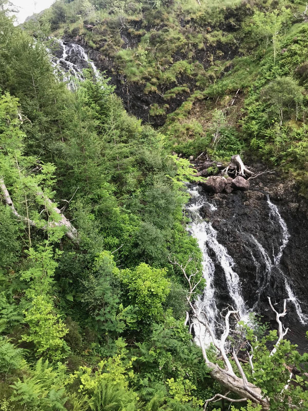
The highlight of the route is a set of waterfalls, high above Flowerdale House, but I walked this route during this past summer, one of the driest on record, so the falls themselves were a pale representation of their normal cascading self, especially after a period of heavy rain, a more likely state of affairs in this part of the country.
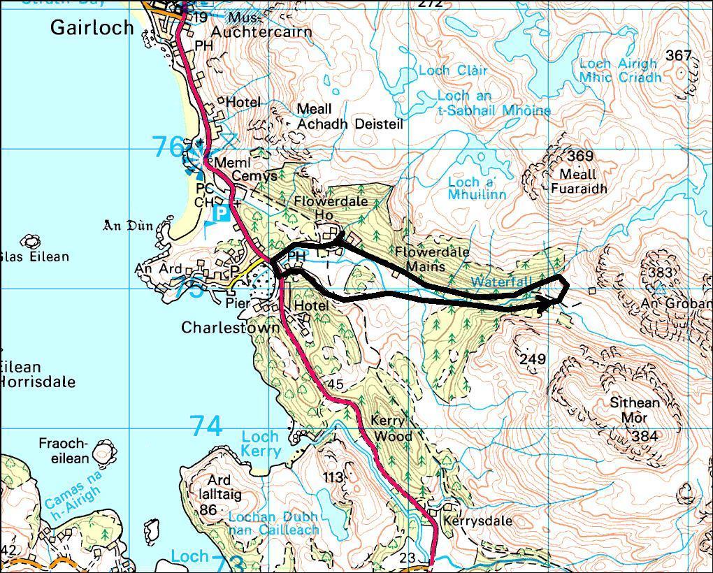
I started from in the little car park just off the A832, opposite the road that leads to Gairloch Pier. An excellent hostelry (worth a visit at the end of the walk), the Old Inn, lay just across the bridge over the Flowerdale River. I didn’t cross the bridge at this point, but continued across the car park to a footpath that passes an information point. Don’t worry too much about navigation on this walk - it’s very well signposted as the Waterfall Walk.
The footpath runs parallel to the main drive to Flowerdale House for a while, although you won’t get much of a view of the house itself. Since 1738 it’s been the seat of the Gairloch Mackenzies.
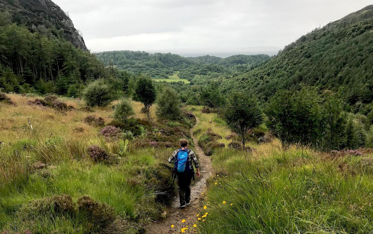
The paths are very good, and well maintained, so just follow the signs at the various junctions. The area is covered mainly by oaks and birches and during my visit, in the height of summer, there was a green glow to everything and a real sense of richness and vibrancy. In many ways this fertile atmosphere runs contrary to these coastal areas of Wester Ross where a lack of trees and a feeling of emptiness is more normal.
Interestingly, at the top of the falls themselves, this sense of green fertility changes quite abruptly and is replaced by the bare and rocky slopes of An Groban (383m) on one side and Sithean Mor (384m) on the other. These twin peaks form a high pass that offers access to a remote and trackless section of lovely Loch Maree.
Promising myself that one day soon I would return and make that journey to Loch Maree, I crossed a footbridge and began the walk down the opposite side of the falls, and a beautiful descent it was. The first section, before the route gets swallowed up by trees again, offers lovely views down the length of the Flowerdale glen and right out to the Western sea beyond Gairloch.
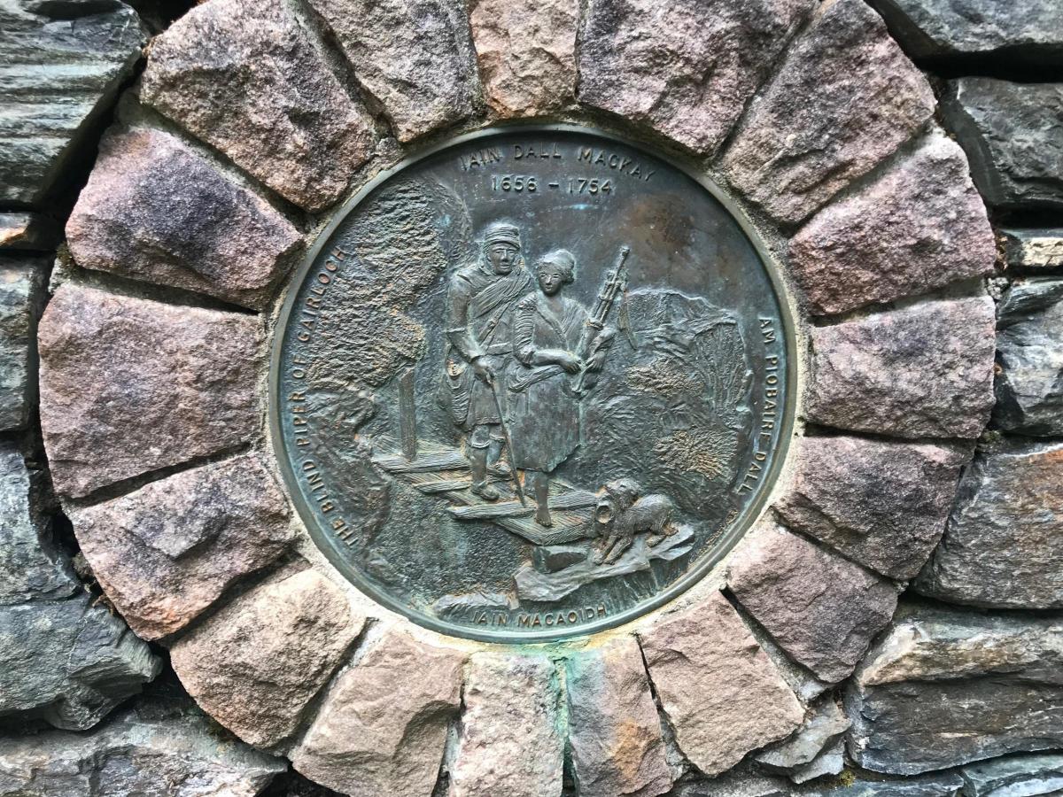
Towards the end of this section through the trees I came across a memorial to the Blind Piper of Gairloch, one Iain Dall Mackay, who lived a surprisingly long life between 1656 and 1754.
Beyond the memorial the path closes its loop and I followed my outward route for short distance to a sign that signalled the route to Cherry Tree Hill. I was keen to return by this route as the final section back to the Old Inn follows a track that was the main road north until the 19th century. As I loped along this grass thoroughfare I found it difficult to believe that horses and carriages, troops of soldiers, poets, tinkers and merchants all travelled this way 150 years ago. A different world.
The Old Inn offered a different world too, an excellent spot to sit outside by the murmuring river with a cold beer. I thought I deserved it.
Cameron McNeish
ROUTE PLANNER
Map: OS 1:50,000 Landranger sheet 19 (Gairloch & Ullapool); Harveys 1:40,000 British Mountain Map, Torridon & Fisherfield.
Distance: 3 miles/5km.
Time: 2 hours.
Start/Finish: Car park beside the Old Inn, Gairloch (GR: NG808752).
Transport: Westerbus service 711, Dingwall to Gairloch. Details from Westerbus, 01445 712255 or https://bustimes.org/operators/WESB
Information: GALE centre, Gairloch (www.galeactionforum.co.uk) or www.visitwester-ross.com .
Route: Leave the car park but don’t cross the bridge. Instead follow the path past the information point and a lily pond. Ignore the sign to the Arboretum Walk but continue on the Waterfall Walk. Pass fences that protect Flowerdale House and continue as route bears R, turn L at the next junction, cross footbridge and boardwalk before crossing another bridge. Continue uphill beside the river to reach T-junction. Turn L, cross bridge over main river and then turn R. Continue past hydro building to another T-junction where you bear R. Climb steadily, past a turning area until you reach a Y-junction. Bear R here onto a narrower, rougher path and climb further. Cross another bridge and continue climbing past the falls onto the edge of open moorland. Cross river by a footbridge and descend all the way to a T-junction. Turn R, cross another bridge, and follow the track to the turning area you passed earlier. Take outward route past Hydro hut, across a bridge and follow signs to Cherry Tree Hill. Turn R onto old main road which is followed to the Old Inn and bridge to car park.


Why are you making commenting on The Herald only available to subscribers?
It should have been a safe space for informed debate, somewhere for readers to discuss issues around the biggest stories of the day, but all too often the below the line comments on most websites have become bogged down by off-topic discussions and abuse.
heraldscotland.com is tackling this problem by allowing only subscribers to comment.
We are doing this to improve the experience for our loyal readers and we believe it will reduce the ability of trolls and troublemakers, who occasionally find their way onto our site, to abuse our journalists and readers. We also hope it will help the comments section fulfil its promise as a part of Scotland's conversation with itself.
We are lucky at The Herald. We are read by an informed, educated readership who can add their knowledge and insights to our stories.
That is invaluable.
We are making the subscriber-only change to support our valued readers, who tell us they don't want the site cluttered up with irrelevant comments, untruths and abuse.
In the past, the journalist’s job was to collect and distribute information to the audience. Technology means that readers can shape a discussion. We look forward to hearing from you on heraldscotland.com
Comments & Moderation
Readers’ comments: You are personally liable for the content of any comments you upload to this website, so please act responsibly. We do not pre-moderate or monitor readers’ comments appearing on our websites, but we do post-moderate in response to complaints we receive or otherwise when a potential problem comes to our attention. You can make a complaint by using the ‘report this post’ link . We may then apply our discretion under the user terms to amend or delete comments.
Post moderation is undertaken full-time 9am-6pm on weekdays, and on a part-time basis outwith those hours.
Read the rules here