


MOVES are being made to create a new Scottish island to help prevent flooding of an Angus coastal town and stop one of the world's oldest golf courses being lost to the sea.
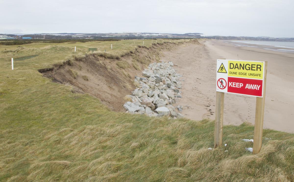
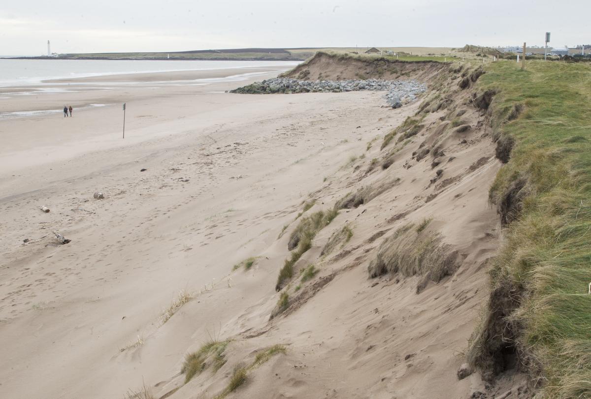
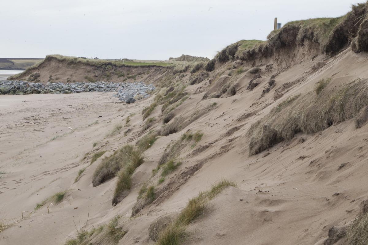
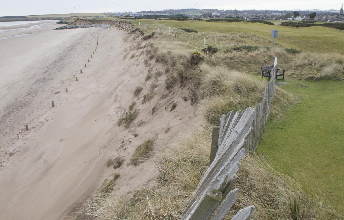
Montrose Golf Links, on Scotland's east coast – which has seen parts of its links eroded by three-and-a-half metres in the last six months alone – is at the centre of multi-agency talks to find ways to dissipate the ravaging tides and waves, and prevent flooding of the town.
Concerns over flooding of Montrose caused by erosion of dunes are known to be among the most urgent in Scotland.
Experts say that, apart from climate change, a key issue has been the erosion of Annat Bank, a Montrose Bay feature which has historically dissipated waves before hitting the shore.
Industrial development at Montrose Harbour has led to the coastline being hardened and defences extended while experts have said port dredging has also played a major part.
Now there are discussions to replace the bank with a sand island, as well extending and reinforcing beaches by adding sand or sediment to combat erosion as part of a multi-million pound project.
READ MORE: Race to save Scotland's greatest golf courses from the sea
Montrose Golf Links, which with more than 450 years of history is the fifth oldest in the world, has been heavily involved in talks about the changing seas and coastal erosion which is threatening to destroy part of the links.
John Adams, the links greens convenor said: "I don't give a monkeys where we get the funding from, you are either going to be giving the residents of Montrose canoes or we are going to have an issue. We really do have a major problem here.
"If you look where I live at St Cyrus, we have got rocks on the beach that used to be 20 foot high, they have disappeared now.
"Either you spend £25m now, or spend £100m in five or less years' time, or you put Montrose underwater – take your pick."
A Scottish Government managing flood risk team briefing from two years ago, seen by The Herald, highlighted the need for action over sand dune erosion that "affect the golf course and the town in Montrose".
At that point it was estimated that between 35 and 40 metres of beach had been lost to the sea since the early 1990s and that the Montrose coastline could wear away by up to 80 metres over the next 40 years.
The experts believed the coastline has been retreating since the 1980s and has been disappearing at a rate of two metres a year.
While some had favoured a £5m coastal hard rock armour defence to be put in place quickly, the team suggested that this would just transfer the problem elsewhere.
At that point, the government had made available funding of £42 million per year for 10 years to enable local authorities to invest in flood protection works.
"The problem is that we are hitting the bottom of the dunes, it is simply eroding the dunes," said Mr Adams. "It is getting serious now – because if it breaches there it could go into Montrose, on the wrong tide and the wrong wind."
A solution is being sought with discussions being held involving the Scottish Government, Scottish Natural Heritage, the Scottish Environment Protection Agency and Angus Council.
"We want the money pulled forward, we just need a solution for Montrose," said Mr Adams. "It has to be substantial – you are talking millions."
A 2017 overview of the threat.
Discussions about improving sea defences in Montrose have been going on for more than two years, but new surveys have been carried out because of concerns that the rate of erosion has increased with the two 18-hole links courses under threat.
In 2018 it was thought that a £5m cash injection from the Scottish Government would reinforce the beach and allow the dunes to recharge.
"Rock armour isn't the answer," said Mr Adams. "Rock armour will work, but visibly it is awful. You are talking three miles. And at £1m every 100 metres it is bloody expensive.
"We have to find a solution and it has to be something that is sustainable.
"The other way to do it – a more sightly way – is to produce an island, which would be two or three kilometres long, slightly offshore. It will do something Annat Bank was doing, but in a different position.
"I believe that is what we need to aim for. It would last between 25 and 50 years. The material the MPA dredge out of the bay can be put on to it, in specific positions.
"It would be an engineered product, an engineered island offshore.
"The waves hit that further offshore, dissipate that, and you don't get that wave motion hitting the sand dunes at Montrose, and we need to get beach recharge as well."
Prof Jim Hansom, the principal researcher of the Dynamic Coast project, who is finishing off an updated examination of the erosion threat to Scotland's coasts, said "beach nourishment" had to be a feature of any efforts to protect Montrose.
READ MORE: Open season. How Kelly Holmes has been part of a mental health podcast revolution.
"The bottom line is that the most effective defence against coastal erosion is a nice, big healthy beach that reconfigures its geometry depending on wave conditions," said Prof Hanson. "So when the wave conditions are low, the beach is nice and flat and when wave energy is high the beach configures itself so that it is much steeper and more absorptive of wave energy.
"Unfortunately when we experience coastal erosion, we reach for engineers, and put a concrete seawall in its place. And a concrete sea wall is often exactly the wrong thing you need to be doing in those sorts of situations.
"A sea wall is going to be too expensive in Montrose and it is probably not going to be very effective on the beach. You want to keep the beach as a recreational asset, and you don't want to change its character, because it is a spectacular beach for all sorts of reasons."
One view on the disappearing golf course.
In 2018, a UK climate change report warned rising seas and coastal erosion had left Montrose Golf Links “with nowhere to go”.
And in the same year, Angus Council revealed Montrose Bay had been chosen as a “super site” for research into the environmental problem.
Montrose Port Authority has been accused of contributing to the erosion when it dredges in the area to keep the entrance to the town's harbour clear and then dumps the material in Lunan Bay a few miles to the south.
Critics say this practice is "wasting" dredged material that could helped protect the dunes, and links director Chris Curnin has previously said if the material was put on to Montrose beach in the “correct” position it would have a “significant impact and slow down the erosion”.
However, the authority has long denied these claims, and an assessment it carried out in 2017 said that episodic weather events – in particular wave direction and height – were linked to the greatest rates of coastal erosion in the area, which took place during the early 1990s.
This period also coincided with the production of a lower volume of dredged navigational channel material.
It then insisted it must be able to continue dumping dredged material around Lunan Bay if the port is to remain operational.


Why are you making commenting on The Herald only available to subscribers?
It should have been a safe space for informed debate, somewhere for readers to discuss issues around the biggest stories of the day, but all too often the below the line comments on most websites have become bogged down by off-topic discussions and abuse.
heraldscotland.com is tackling this problem by allowing only subscribers to comment.
We are doing this to improve the experience for our loyal readers and we believe it will reduce the ability of trolls and troublemakers, who occasionally find their way onto our site, to abuse our journalists and readers. We also hope it will help the comments section fulfil its promise as a part of Scotland's conversation with itself.
We are lucky at The Herald. We are read by an informed, educated readership who can add their knowledge and insights to our stories.
That is invaluable.
We are making the subscriber-only change to support our valued readers, who tell us they don't want the site cluttered up with irrelevant comments, untruths and abuse.
In the past, the journalist’s job was to collect and distribute information to the audience. Technology means that readers can shape a discussion. We look forward to hearing from you on heraldscotland.com
Comments & Moderation
Readers’ comments: You are personally liable for the content of any comments you upload to this website, so please act responsibly. We do not pre-moderate or monitor readers’ comments appearing on our websites, but we do post-moderate in response to complaints we receive or otherwise when a potential problem comes to our attention. You can make a complaint by using the ‘report this post’ link . We may then apply our discretion under the user terms to amend or delete comments.
Post moderation is undertaken full-time 9am-6pm on weekdays, and on a part-time basis outwith those hours.
Read the rules hereLast Updated:
Report this comment Cancel