


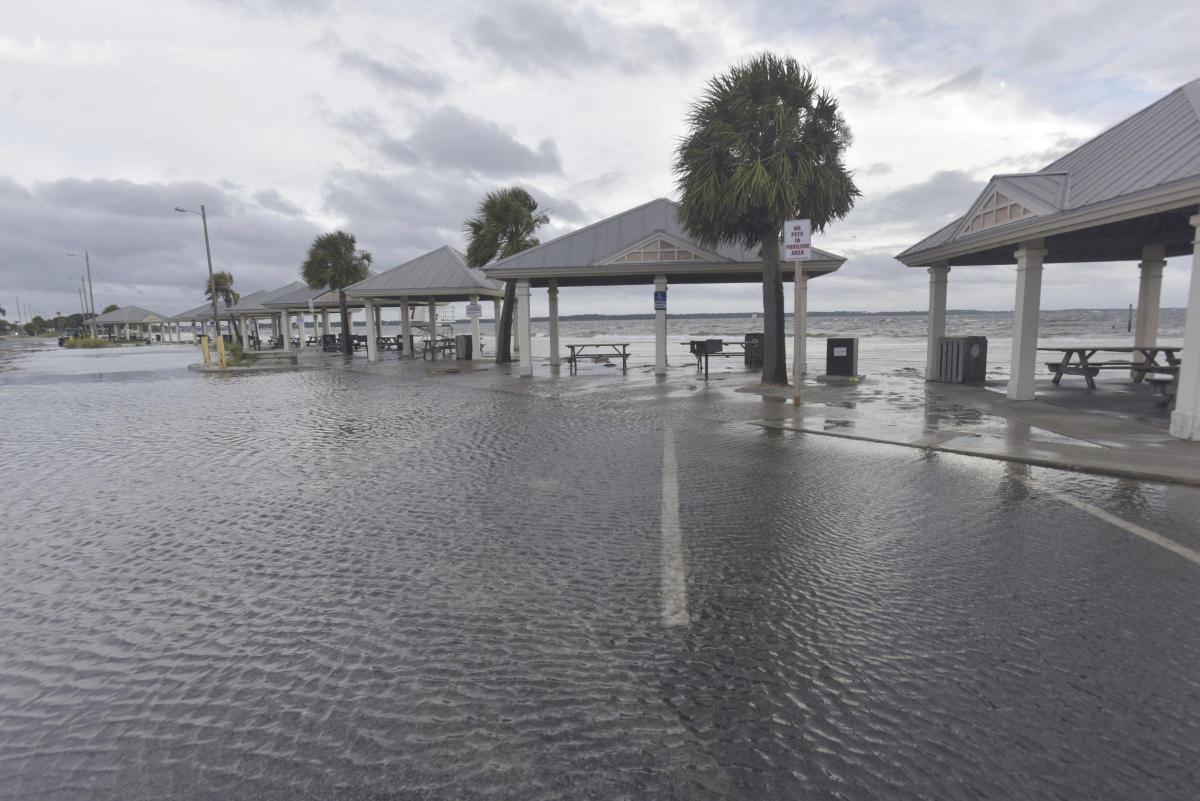


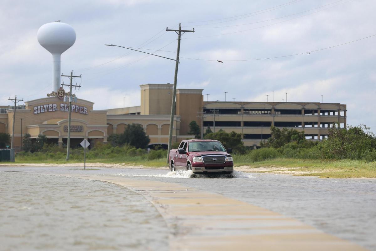
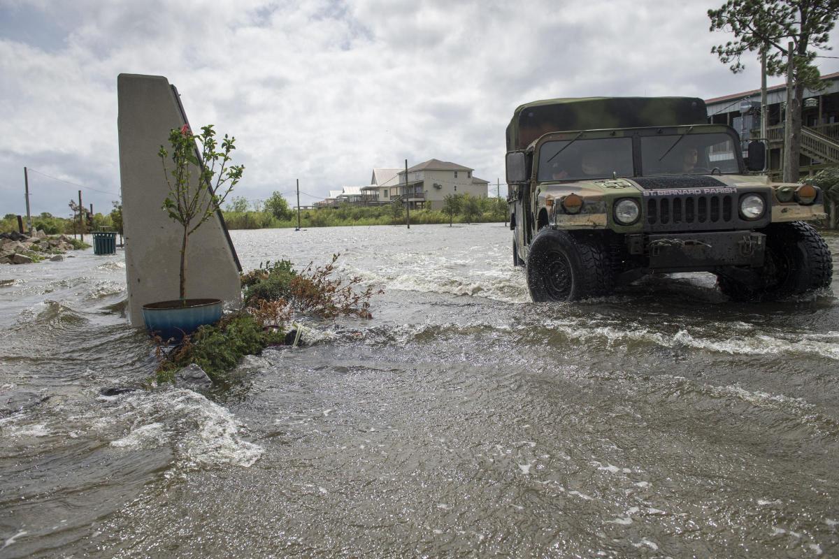


Hurricane Sally, a plodding but powerful storm with winds of 85mph, is creeping towards the northern Gulf Coast with forecasters warning of potentially deadly storm surges, flash floods spurred by up to 2ft of rain and the possibility of tornadoes.
Hurricane warnings have been replaced by a tropical storm warning from the mouth of the Pearl River westwards to Grand Isle, Louisiana, including in New Orleans, the National Hurricane Centre said. A tropical storm warning west of Grand Isle has been discontinued.
Hurricane warnings had stretched from Grand Isle to Navarre, Florida, but forecasters - while stressing "significant" uncertainty - kept nudging the predicted track to the east.
That eased fears in New Orleans, which once was in the storm's crosshairs, but it prompted Florida governor Ron DeSantis to declare an emergency in the Panhandle's westernmost counties, which were being pummelled by rain from Sally's outer bands early on Tuesday.
The threat of heavy rain and storm surge was exacerbated by the storm's slow movement.
President Donald Trump issued emergency declarations for parts of Louisiana, Mississippi and Alabama on Monday, and urged residents to listen to state and local leaders.
Alabama governor Kay Ivey sought the presidential declaration after the National Weather Service in Mobile, Alabama, warned of the increasing likelihood of "dangerous and potentially historic flooding", with water rising as much as 9ft above ground in parts of the Mobile area.
Sally achieved hurricane strength on Monday and quickly intensified to a Category 2 storm with 100mph winds, but by Tuesday morning, maximum sustained winds had decreased to 85mph, making it a Category 1 storm, although forecasters say some restrengthening is expected later.
The storm was south-south-east of Biloxi, Mississippi, and east-south-east of the mouth of the Mississippi River, moving at only 2mph.
Forecasters expect the storm to turn northwards on Tuesday afternoon and travel slowly north-north-eastward from Tuesday night through Wednesday.
The National Hurricane Centre said early on Tuesday that the centre of the hurricane would be moving near the coast of south-eastern Louisiana later in the day.
Forecasters expect winds to increase to up to 110mph over the warm Gulf waters before the storm blows ashore. On the current track, Sally is forecast to reach land near the Alabama-Mississippi border by late Tuesday or early Wednesday.
Monday marked only the second time on record that five tropical cyclones swirled simultaneously in the Atlantic basin. The last time that happened was in 1971.
None of the others are expected to threaten the US this week, if at all, and one was downgraded to a low pressure trough on Monday evening.


Why are you making commenting on The Herald only available to subscribers?
It should have been a safe space for informed debate, somewhere for readers to discuss issues around the biggest stories of the day, but all too often the below the line comments on most websites have become bogged down by off-topic discussions and abuse.
heraldscotland.com is tackling this problem by allowing only subscribers to comment.
We are doing this to improve the experience for our loyal readers and we believe it will reduce the ability of trolls and troublemakers, who occasionally find their way onto our site, to abuse our journalists and readers. We also hope it will help the comments section fulfil its promise as a part of Scotland's conversation with itself.
We are lucky at The Herald. We are read by an informed, educated readership who can add their knowledge and insights to our stories.
That is invaluable.
We are making the subscriber-only change to support our valued readers, who tell us they don't want the site cluttered up with irrelevant comments, untruths and abuse.
In the past, the journalist’s job was to collect and distribute information to the audience. Technology means that readers can shape a discussion. We look forward to hearing from you on heraldscotland.com
Comments & Moderation
Readers’ comments: You are personally liable for the content of any comments you upload to this website, so please act responsibly. We do not pre-moderate or monitor readers’ comments appearing on our websites, but we do post-moderate in response to complaints we receive or otherwise when a potential problem comes to our attention. You can make a complaint by using the ‘report this post’ link . We may then apply our discretion under the user terms to amend or delete comments.
Post moderation is undertaken full-time 9am-6pm on weekdays, and on a part-time basis outwith those hours.
Read the rules hereLast Updated:
Report this comment Cancel