
Location: Pitlochry and Moulin,
Perthshire
Grade: Easy walk on good paths and minor roads
Distance: 5 miles/8km
Time: 2-3 hours
Pitlochry has a great network of paths, and on the excellent local Pitlochry Walks Network leaflet you can see how they radiate out from the town, enabling you to get into attractive countryside very easily.
This route heads north to the village of Moulin, passing an ancient castle, before returning by a different route and including a riverside walk to finish.
The route out of Pitlochry passes behind the imposing Atholl Palace Hotel, which with its towers and turrets is often mistaken by visitors for a castle.
The walk takes in a path known as Lovers’ Lane which passes the hotel’s herb garden – worth a look if you are interested in herbs.
At the end of Lovers’ Lane, look for the sign pointing left to ‘Moulin via Caisteal Dubh’. This path gives great views of Ben Vrackie, the ever-popular Corbett which rises north-east of Pitlochry.
Follow the path to another junction with a footbridge and go straight on along the field edge, diverting to walk across to the ruin of Caisteal Dubh, the Black Castle.
It dates back to the 14th century but in about 1500 a terrible plague swept across the area.
A rumour spread that the plague had reached the castle and it was burned down by locals in an attempt to keep the plague at bay.
Moulin is a very attractive wee village. It was originally a more important place than Pitlochry, at a time when glen floors were avoided as through routes, being generally heavily wooded, often wet and a hiding place for wild beasts and felons.
Main roads went across the hill slopes, and the road north passed through Moulin (which means ‘the place of the mill’).
This being the case, a defensive stronghold was naturally needed, hence Caisteal Dubh.
The Moulin Inn is very welcoming and offers refreshments all day (depending on Covid restrictions) and across the road from it the former church is now a heritage centre.
The route out of Moulin passes a small brewery, one of the first to be set up in Scotland (there are now over 100).
If it is open you can take a tour and maybe pick up one of their craft beers to take home with you.
The minor road which you now follow gives excellent views down across the town and also looking north towards Killiecrankie, with the wooded Craigower (another fine walk) to the right.
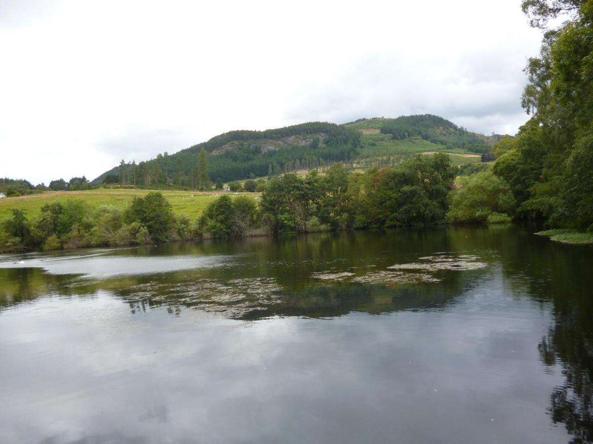
The walk passes an attractive pond called The Cuilc and continues across the main road to visit Pitlochry’s dam and fish ladder, built here to assist salmon trying to get upriver to spawn.
The riverside walk passes below the Pitlochry Festival Theatre which has an extensive Explorers’ Garden before crossing the turbulent River Tummel on a suspension bridge at Port na Craig which can sway alarmingly if there are many people on it. Don’t worry, it’s quite safe!
The bridge holds a large collection of padlocks left here by couples as a mark of their undying love.
I am sure after enjoying this walk you will want to return.
Roger Smith
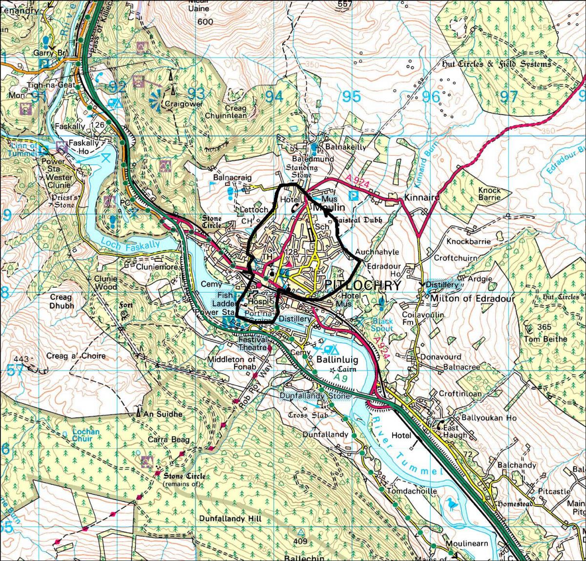
ROUTE PLANNER
Map: OS 1:50,000 Landranger sheet 52 (Pitlochry & Crieff) or Pitlochry Walks Network leaflet available at the TIC.
Distance: 5 miles/8km
Approx Time: 2-3 hours
Start/Finish: Pitlochry Tourist Information Centre (GR: NN942581)
Transport: Regular bus and train services to Pitlochry from Glasgow and Edinburgh (www.travelinescotland.com)
Information: Pitlochry TIC, 01796 472215. To check opening times for the Brewery call the Moulin Inn on 10796 472196.
Route: From the TIC walk east on main road. Just before railway bridge TL, taking the R fork (Knockfarrie Road). Follow it past rear of Atholl Palace Hotel and continue on Lovers’ Lane path. When this ends (footbridge on right), TL on path signed ‘Moulin via Caisteal Dubh’. Follow path to another junction then follow field edge. Divert to look at Caisteal Dubh, return to field edge and at fence corner head across field aiming just left of church to reach a metal gate with an information board.
Walk out to main road, TR and pass Moulin Inn. Take next L (Baledmund Road). Follow road past new houses and uphill. Turn sharp L and walk down past golf course and The Cuilc. Keep L on road then turn L and R down Larchwood Rd. Cross main road and follow signs down Rie-achan Rd and Armoury Rd to dam. Cross dam and TL down steps to road. Walk along by river and look for gap on L leading to suspension bridge across R.Tummel. Walk up to Ferry Rd and follow it up to town centre.
Due to restrictions, we are running our favourite previously published walks.


Why are you making commenting on The Herald only available to subscribers?
It should have been a safe space for informed debate, somewhere for readers to discuss issues around the biggest stories of the day, but all too often the below the line comments on most websites have become bogged down by off-topic discussions and abuse.
heraldscotland.com is tackling this problem by allowing only subscribers to comment.
We are doing this to improve the experience for our loyal readers and we believe it will reduce the ability of trolls and troublemakers, who occasionally find their way onto our site, to abuse our journalists and readers. We also hope it will help the comments section fulfil its promise as a part of Scotland's conversation with itself.
We are lucky at The Herald. We are read by an informed, educated readership who can add their knowledge and insights to our stories.
That is invaluable.
We are making the subscriber-only change to support our valued readers, who tell us they don't want the site cluttered up with irrelevant comments, untruths and abuse.
In the past, the journalist’s job was to collect and distribute information to the audience. Technology means that readers can shape a discussion. We look forward to hearing from you on heraldscotland.com
Comments & Moderation
Readers’ comments: You are personally liable for the content of any comments you upload to this website, so please act responsibly. We do not pre-moderate or monitor readers’ comments appearing on our websites, but we do post-moderate in response to complaints we receive or otherwise when a potential problem comes to our attention. You can make a complaint by using the ‘report this post’ link . We may then apply our discretion under the user terms to amend or delete comments.
Post moderation is undertaken full-time 9am-6pm on weekdays, and on a part-time basis outwith those hours.
Read the rules here