

ALL eyes were on Glasgow when world leaders, environmentalists and activists descended on the city for COP26.
Last November’s conference might have seen countries agree to pledge further cuts to emissions of carbon dioxide (CO2), a greenhouse gas which causes climate change, to try to keep temperature rises within 1.5C, the level scientists say is required to prevent a “climate catastrophe.”
However, it is climate change issues here in Glasgow and the west of Scotland that have taken centre stage with an increasing sense of urgency.
Read more: Wedding venue near Glasgow launched by six farming siblings
The earliest flooding recorded in the area was from 738AD when the River Clyde burst its banks and right up to the present day it is still an issue with rising water levels due to Storm Malik earlier this year.
Glasgow is a city whose reputation was founded on the famous River Clyde. It was once renowned for its shipbuilding industry with thousands of people employed along the west coast riverside including in places such as Clydebank, Port Glasgow and Greenock.
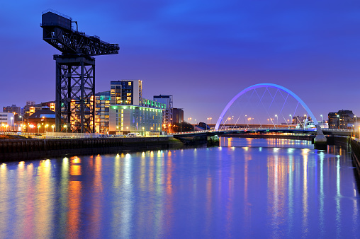
Glasgow is a city whose reputation was built on the famous River Clyde
Decades on urbanists and architectural experts believe that regeneration of the Clyde will be the key to future economic success in the area.
After great physical changes due to the loss of docks and dredging becoming a thing of the past, as well as a narrowing of the river in parts, climate change and increased rainfall are now among a mix of challenges ahead.
As reported in The Herald, a recent study shows the city is facing increased flooding and heat stress due to climate change which will have detrimental effects on public health and social equality, according to the World Health Organisation’s Health and Climate Change Urban Profile.
Glasgow is one of six front-runner cities from around the world being profiled by the WHO for their plans on mitigating and adapting to climate change. Its projections for the Clyde river basin suggest that rainfall from October to March will increase by up to 42% by 2050 if greenhouse gas emissions remain high and that the River Clyde poses a significant flooding risk to 32% of the total city area, as current sea levels are expected to rise by approximately 50cm by 2080.
It is estimated 45,200 homes, businesses and services are considered at risk of flooding in the Glasgow City Council area – a figure predicted to increase to 57,000 by 2080 due to the impact of climate change.

One of the many protests ahead of COP26. Performers from Ocean Rebellion dressed as Prime Minister Boris Johnson and an Oilhead set light to the sail of a small boat which reads "Your Children's Future" as they burn stacks of money on the banks of the
So how does Scotland’s largest city and its closest towns and communities navigate through the complexities of creating new developments along the riverside with climate change causing sea levels to rise?
The Clyde has always been a key part of economic and social life in the west of Scotland, and the Glasgow region has a vision for a climate-resilient river corridor that supports a mix of land uses and provides attractive spaces where people want to spend time.
And as a way to help ensure this vision is achieved Glasgow City Council, along with the Scottish Environmental Protection Agency, Sepa, have delivered a new River Clyde Tidal Flood Model, covering the area on the river between Dalbeth in Glasgow and Greenock.
Read more: Glasgow mural believed to be lost for decades is unveiled in city
With sea levels predicted to rise because of climate change, as a result, the risk of flooding for existing and new communities will increase.
It is intended that information from the model will be used by developers, planners, investors and organisations and individuals to help them prepare for the challenges ahead. The collaboration between Glasgow City Council and Sepa will inform the management of flood risk on the Clyde and replaces the River Clyde Flood Management Strategy model.
Sepa and local authorities agree that the model offers the best available understanding of current and future flood risk from the tidal Clyde for coastal flooding events, including storm surges and sea level rise, to the year 2100.
Low lying areas of land adjacent to the River Clyde are most likely to be at risk of flooding from the Clyde.
The model supports the information on the Sepa Flood Maps which are due to be updated to take account of the information from the model.
The shift to the new model isn’t about deterring development, but to allow planners and organisations to access more information while taking into account rising sea levels.
New maps show cross-sections along the river that can be used to determine the peak water levels at locations along the river, for the purpose of initial screening of flood risk. For the Clyde river basin region, the sea-level rise allowance recommended to the year 2100 is 0.85m.
Beyond 2100, the recommendation is an additional allowance of 0.15m per decade which means for the year 2140, the recommended sea level rise allowance would be 1.45m.
For developers the consideration of tidal flooding is increasingly important as rising sea levels mean that flooding associated with high tides and storm events will occur to a greater level and cover a larger area of land than at present.
Development sites along the banks of the Clyde, many of which have lain vacant for many years, should be developed in a way that recognises the challenge of increased flood risk due to climate change.
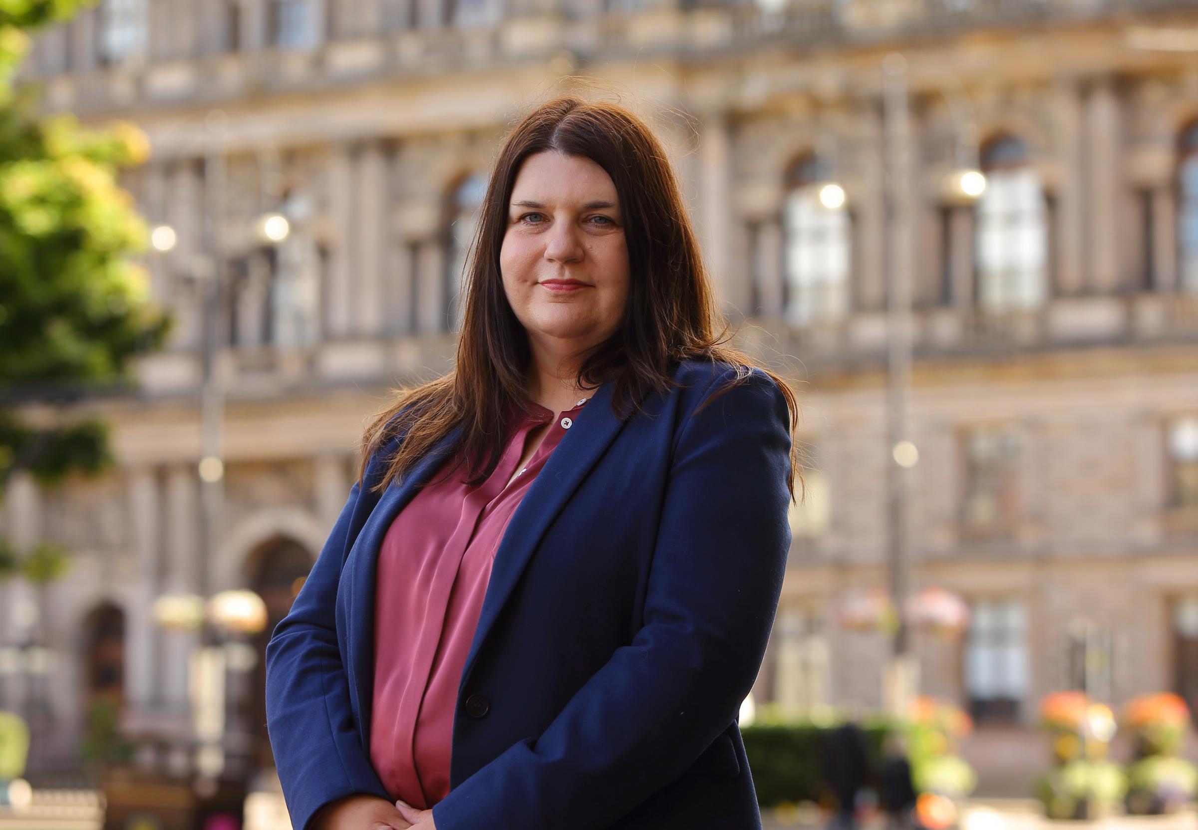
Glasgow council leader Susan Aitken said the new River Clyde Tidal Flood Model will allow proper management of flood risk along the river
Councillor Susan Aitken, Leader of Glasgow City Council and chairman of the Glasgow City Region Cabinet, said: “The Clyde is central to the life of Glasgow and our neighbouring local authorities and, like all other such rivers, has to face the reality of climate change.
“The new River Clyde Tidal Flood Model will allow proper management of flood risk along the river, ensuring that appropriate development takes place on its banks and flood plains.
“This management will ensure that the economic, environmental and social benefits of the many uses – both existing and to come – on the Clyde can continue to be delivered for future generations.”
While steps are being taken to develop a long-term adaptation approach for the River Clyde and wider City Region, one expert who has spent a lifetime on the river believes there needs to be a number of changes.
Riverman George Parsonage, who led Glasgow Humane Society’s rescue missions for many years, said: “Many years ago I remember being at a meeting with the council over concerns of water lapping up over the present quay wall.
“I showed them a photograph which dated back to around 1913 and showed ships at high tide and it was exactly at the same height.”
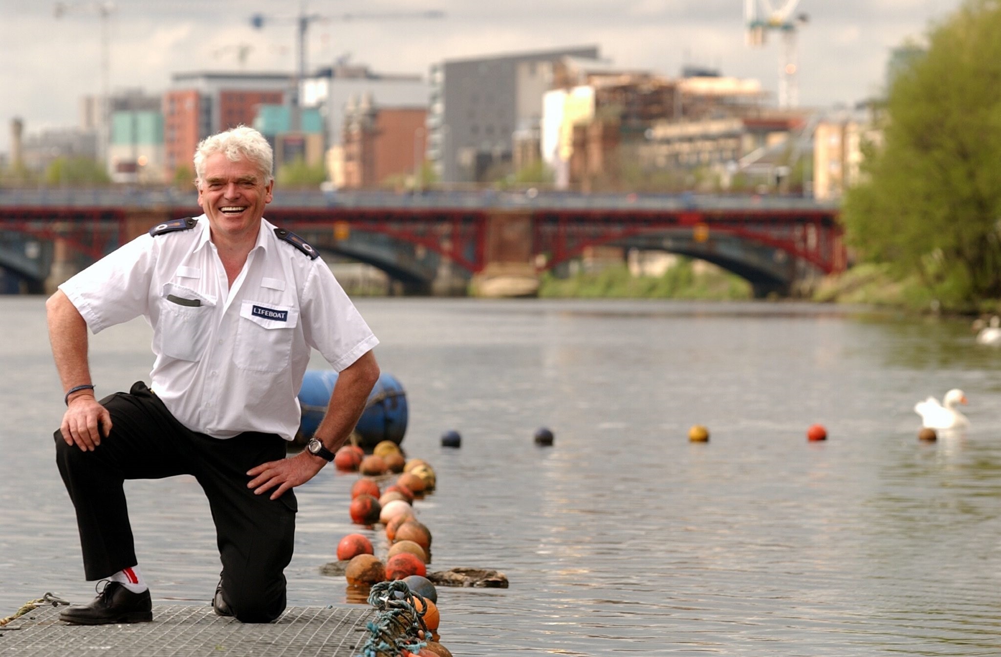
George Parsonage of the Glasgow Humane Society in Glasgow Green beside the River Clyde.
While climate change is one battle, Mr Parsonage does believe measures could be put in place to help the river.
“The river is only a fraction of the width it used to be,” he added. “The whole of the Clyde was wooden quay walls and quay walls slope back, but it has been piled where the wooden walls were.
“Most of the docks are away so there is less than half the water left in the river. There is no dredging being carried out in the upper harbour and there are parts of the river which dropped in depth but are now level. Low tide below the Tradeston Bridge you only have a couple of metres of water, so it is very shallow now.
“If the Clyde isn’t dredged and is being narrowed I don’t see where the water is going to go and that worries me.
“We could have had areas for boating and marinas were talked about in the past, but these have all been taken away. However, these areas were also flood plains. Narrowing and not dredging the river all adds up.
“With the exception of flooding in the likes of Shettleston, we are lucky that we have a river that takes all the water away from the Clyde Valley without causing devastating flooding to a city, but we also have to look after our riverbanks with the removal of heavy trees to allow rainfall to have somewhere to go.
“I think we have also got to clean the main rivers – the Kelvin, the Clyde and the Cart so when the heavy rainwater does come it has a free run right down into the Clyde and into the estuary.”
A key first step in developing a framework for adaptation will be the publication, in the coming weeks, of a report that provides options analysis and scoping of potential adaptation pathways for the tidal Clyde.
Vincent Fitzsimons, head of Hydrology and Flooding at Sepa, said: “Scotland is already seeing the impacts of a changing climate. We know that there is locked in climate change we cannot reverse – including sea level rise. Climate change is a huge challenge and Sepa is pleased to have worked with Glasgow City Council to develop the Tidal Clyde Model as a shared tool to be used by all partners.
“Sepa endorses it as the current best available data to help assess the flood risk ahead for land use planning to allow communities in the area to thrive. Avoiding or adapting to flooding is a fundamental consideration in the design of great places as we learn to live safely with flooding both now and in the future.”
Information on the new River Clyde Tidal Flood Model is available at: https://www.glasgow.gov.uk/riverclydemodelguidance


Why are you making commenting on The Herald only available to subscribers?
It should have been a safe space for informed debate, somewhere for readers to discuss issues around the biggest stories of the day, but all too often the below the line comments on most websites have become bogged down by off-topic discussions and abuse.
heraldscotland.com is tackling this problem by allowing only subscribers to comment.
We are doing this to improve the experience for our loyal readers and we believe it will reduce the ability of trolls and troublemakers, who occasionally find their way onto our site, to abuse our journalists and readers. We also hope it will help the comments section fulfil its promise as a part of Scotland's conversation with itself.
We are lucky at The Herald. We are read by an informed, educated readership who can add their knowledge and insights to our stories.
That is invaluable.
We are making the subscriber-only change to support our valued readers, who tell us they don't want the site cluttered up with irrelevant comments, untruths and abuse.
In the past, the journalist’s job was to collect and distribute information to the audience. Technology means that readers can shape a discussion. We look forward to hearing from you on heraldscotland.com
Comments & Moderation
Readers’ comments: You are personally liable for the content of any comments you upload to this website, so please act responsibly. We do not pre-moderate or monitor readers’ comments appearing on our websites, but we do post-moderate in response to complaints we receive or otherwise when a potential problem comes to our attention. You can make a complaint by using the ‘report this post’ link . We may then apply our discretion under the user terms to amend or delete comments.
Post moderation is undertaken full-time 9am-6pm on weekdays, and on a part-time basis outwith those hours.
Read the rules hereLast Updated:
Report this comment Cancel