

Forecasters have warned of 75-mph winds and “dangerous conditions” as the first named storm of the autumn blows in to Scotland today.
Storm Agnes is prediected to arrive at midday bringing high winds, heavy seas and rain before cealring the country on Thursday.
A string of Met office alerts have been put in place for today, with a yellow wind weather warning from midday on Wednesday to 7am on Thursday stretching across Scotland, and two yellow rain warnings covering areas of Scotland from 3pm on Wednesday to midnight.
This could lead to disruption to power as lines are downed plus hazardous driving conditions and cancelled ferries. There could also be damage to property.
Storm Agnes is due to make landfall on the west coast of Ireland this morning before its strong winds hit the UK closer to noon.
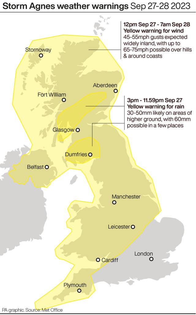 (PA Graphics)
Storm Agnes, which was described as “intensifying quickly” in the Atlantic during Tuesday evening, is expected to generate winds of up to 75mph and cause dangerous conditions along coastlines, especially Irish Sea coastlines.
Its main impact will be strong winds and large waves.
READ MORE: Storm Agnes brings 'Danger to life' warning in Scotland
Met Office meteorologist Tom Morgan said: “We are likely to potentially see some damaging winds, the possibility of some brief power interruptions, particularly in Irish sea coastal areas.
“So Northern Ireland, north-west England, west Wales, and south-west Scotland, that’s where we’ll probably see gusts of up to 75mph (Wednesday) afternoon, (Wednesday) evening, that’s when the peak of the winds will be and then Storm Agnes will move across Scotland clearing away from Shetland through Thursday morning.”
🌊 As well as strong winds, #StormAgnes will also bring very rough seas and large waves, especially through the Irish Sea
🛳️ With high spring tides, some coastal areas are at risk of flooding and some ferry services may be disrupted pic.twitter.com/EJm2eUpa1F
— Met Office (@metoffice) September 26, 2023
He added: “In addition to the winds, there’s going to be some large waves as well, so some big stormy seas, and therefore there might well be some coastal flooding where the waves break on to promenades and on to coastal roads.”
The storm is likely to cause “dangerous conditions” on the coasts around the UK and Ireland, according to The Royal National Lifeboat Institution (RNLI).
They advised staying a “safe distance” away from the water and cliff edges to avoid being knocked over or washed into the sea.
RNLI water safety partner Sam Hughes said: “It is not worth risking your life.
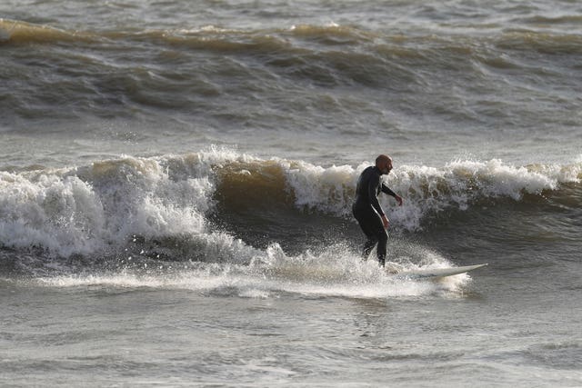 Surfers make the most of the conditions at Sandy Bay in Porthcawl, Wales (Joe Giddens/PA)
“If you see someone else in danger in the water, call 999 or 112 and ask for the Coastguard. If you have something that floats that they can hold on to, throw it to them. Don’t go in the water yourself – you may end up in difficulty too.”
Disruption to ferry services across the Irish Sea, bridge closures, power cuts and “small amounts” of damage to buildings are also expected.
READ MORE: Met Office alert for 'disruptive' strong winds
Storm Agnes will be “more widespread” than the last named storm to hit the UK, Storm Betty, but it will not produce “significant widespread and long lasting travel disruption”, it is understood.
On Thursday, most parts of the UK will be poised for a “much calmer” forecast and further spells of wet and breezy weather should peter out by the end of the week for a drier weekend.


Why are you making commenting on The Herald only available to subscribers?
It should have been a safe space for informed debate, somewhere for readers to discuss issues around the biggest stories of the day, but all too often the below the line comments on most websites have become bogged down by off-topic discussions and abuse.
heraldscotland.com is tackling this problem by allowing only subscribers to comment.
We are doing this to improve the experience for our loyal readers and we believe it will reduce the ability of trolls and troublemakers, who occasionally find their way onto our site, to abuse our journalists and readers. We also hope it will help the comments section fulfil its promise as a part of Scotland's conversation with itself.
We are lucky at The Herald. We are read by an informed, educated readership who can add their knowledge and insights to our stories.
That is invaluable.
We are making the subscriber-only change to support our valued readers, who tell us they don't want the site cluttered up with irrelevant comments, untruths and abuse.
In the past, the journalist’s job was to collect and distribute information to the audience. Technology means that readers can shape a discussion. We look forward to hearing from you on heraldscotland.com
Comments & Moderation
Readers’ comments: You are personally liable for the content of any comments you upload to this website, so please act responsibly. We do not pre-moderate or monitor readers’ comments appearing on our websites, but we do post-moderate in response to complaints we receive or otherwise when a potential problem comes to our attention. You can make a complaint by using the ‘report this post’ link . We may then apply our discretion under the user terms to amend or delete comments.
Post moderation is undertaken full-time 9am-6pm on weekdays, and on a part-time basis outwith those hours.
Read the rules hereLast Updated:
Report this comment Cancel